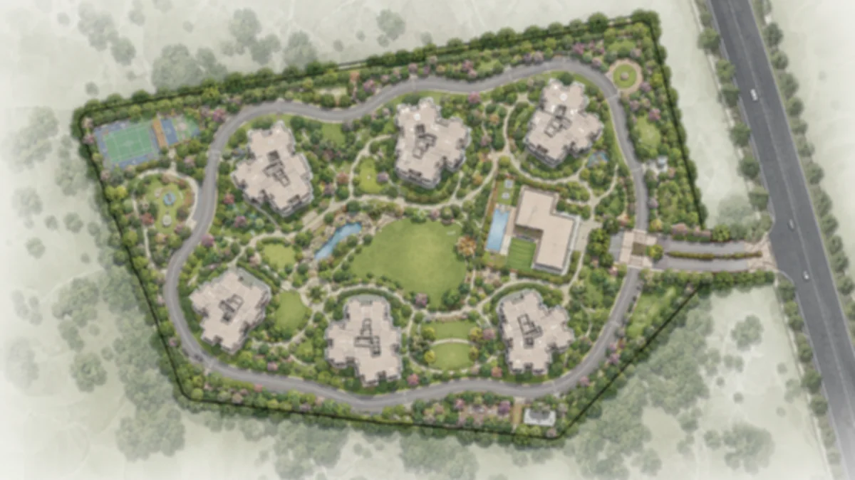
What does exist is unusually good for a project at this stage: a granted environmental Terms of Reference, filed by the developer with the State Level Expert Appraisal Committee, Karnataka, and published on the MoEFCC's PARIVESH portal. That filing fixes the outer envelope — the land, the built-up area, the tower count, the floor configuration, the maximum height and the number of basement levels. From that envelope a considerable amount can be derived arithmetically, and this page does that derivation openly, showing the working and labelling every output as an estimate.
Three registers run through everything below, and they are marked as they occur. Figures from the developer's environmental filing are stated plainly and sourced. Figures from the project information supplied to us are attributed, never asserted. Figures we derived ourselves are shown with their arithmetic and called estimates. Where a number simply does not exist, this page says so rather than filling the gap.
The Filed Envelope
| Element | Value | Source |
|---|---|---|
| Land area | 7.527 hectares — 18.60 acres | Environmental filing |
| Survey numbers | Sy. Nos. 32/2, 32/3, 33/1, 33/2, 33/3, 34/1, 34/2, 34/3, 85/1, 85/2, 85/3, 83/1(P), 83/2(P), 82/5 | Environmental filing |
| Land tenure | Joint Development Agreement, status "Acquired" | Environmental filing |
| Apartments | 1,215, plus a clubhouse | Environmental filing |
| Residential towers | 6 | Environmental filing |
| Tower configuration | 3 basements + ground + 45 upper floors | Environmental filing |
| Maximum height | 142.7 metres | Environmental filing |
| Clubhouse | A separate ground-floor structure | Environmental filing |
| Proposed built-up area | 279,068.99 sq m — 3.00 million sq ft | Environmental filing |
| Stated project cost | ₹600 crore | Environmental filing |
| Category | B1, Schedule item 8(b), Townships and Area Development Projects | Environmental filing |
The developer's filing describes the scheme in its own words as "a residential development comprising 1,215 apartments and a clubhouse. The apartments are distributed across six towers, each with a configuration of 3 Basements + Ground Floor + 45 Upper Floors (3B + G + 45UF), reaching a maximum height of 142.7 meters. The clubhouse is proposed as a ground-floor structure." That is the whole of the published design description. Everything after this section is arithmetic performed on it.
One clarification that belongs here rather than in a footnote: what was granted in April 2026 is Terms of Reference, not an Environmental Clearance. A ToR is the scoping approval that determines what the environmental impact study must cover. The Environmental Clearance application itself was filed on 23 July 2026 and is under verification. The project is not "environmentally cleared", and this site will not describe it that way.
The Parcel — Size and Shape
18.60 acres is 810,216 sq ft, or 75,270 sq m. If the parcel were square, that is roughly 274 metres on a side, with a diagonal of about 388 metres. It is a compact site by the standards of a 1,215-home scheme, and the practical consequence is that internal walking distances will be short — the farthest tower entrance to the clubhouse is unlikely to be more than a three-to-four-minute walk, whatever the eventual layout does.
The filing records a site extent running from a north-eastern corner at 12.978521, 77.804561 to a south-western corner at 12.983435, 77.807228. Converting that to ground distance gives a bounding box of roughly 547 metres north–south by 289 metres east–west, an area of about 15.8 hectares. The parcel is 7.527 hectares, so it occupies under half of its own bounding box — which tells us the land is irregular in shape rather than a neat rectangle, most likely elongated on a north–south axis with sections of the box excluded. That is our reading of the filed coordinates, not a published site boundary, and the actual geometry is not public. The parcel fronts NH-648 307 metres from the pin; on which face, and over what length of frontage, has not been published.
Density — What 18.6 Acres Has to Absorb
1,215 apartments ÷ 18.60 acres = 65.3 apartments per acre
That is the headline density, and in this corridor it is a genuine positive rather than a marketing line, because the comparison set is public:
| Scheme | Units | Acres | Apartments per acre |
|---|---|---|---|
| Godrej Parkshire, Sarakariguttahalli | 1,132 | 14 | 80.9 |
| Provident Botanico, Soukya Road | 1,275 | 17.12 | 74.5 |
| Sobha One World, Hoskote taluk | 3,484 | 48 | 72.6 |
| Embassy Millennium | 1,215 | 18.60 | 65.3 |
Embassy Millennium is the least dense of the four large schemes on this corridor — around 19 per cent less dense than Godrej Parkshire and 12 per cent less than Provident Botanico. That is a verifiable, arithmetic comparison rather than a claim about quality, and it is the strongest thing the numbers say about this site plan.
Density on its own does not settle how much of the ground plane a resident actually gets, though. That depends on how much of the site the buildings and their basements cover, which is the next question.
Floor Area Ratio
279,068.99 sq m of built-up area ÷ 75,270 sq m of land = FAR 3.71 on total built-up area
That 3.71 is the ratio on the total built-up figure in the filing, which includes three basement levels and the full common-area load. A sanctioned FAR is calculated differently — it strips basement parking and a portion of the common area — and will therefore be a materially lower number.
Working the above-ground portion out: at roughly 7,200 sq ft of built-up per floor plate across 270 upper-floor plates, above-ground construction comes to approximately 1.95 million sq ft, which against 810,216 sq ft of land is a FAR of about 2.41. That is our estimate, derived from the filed total, and neither figure has been published as a sanctioned FAR.
We cannot tell you the permissible FAR at this parcel, and nobody honestly can yet. The land-use zone for these survey numbers under the Hoskote LPA Master Plan 2031 is not in the public record we were able to reach, and it is not even settled whether this parcel falls under Hoskote Planning Authority or the Satellite Town Ring Road Planning Authority — the two Local Planning Authorities under BMRDA that could cover Anugondanahalli hobli. Plan sanction rests with whichever of them it is. Until a sanction reference exists, the relationship between 3.71 and the permitted ceiling is an open question.
One further ratio is worth publishing because it explains where three million square feet goes:
3,003,884 sq ft of built-up ÷ 1,215 homes = 2,472 sq ft of built-up per home
Against a saleable area of roughly 1,340 sq ft per home — using the midpoint of the configuration ladder in the project information supplied to us, which is itself unconfirmed — that is a ratio of about 1.85 to 1. A ratio that high is exactly what three basement levels of parking, plant and services produces, and it is consistent with the filed configuration rather than surprising.
Towers and Floor Plates
1,215 apartments ÷ 6 towers = 202.5 homes per tower
202.5 ÷ 45 upper floors = 4.5 homes per floor plate
~1,950,000 sq ft above ground ÷ 270 floor plates = about 7,200 sq ft per plate
A 7,200 sq ft plate is a footprint of roughly 27 metres square
142.7 m of height on a 27 m base = a slenderness ratio of about 5.3 : 1
This is the most distinctive thing about the scheme, and it is worth being precise about how we arrived at it — including where we were wrong.
Before the developer's filing was located, we reasoned from the client-supplied unit count that four to five homes per floor plate implied an implausibly slender tower, and that a corridor-normal envelope for 1,215 homes would sit nearer twenty-five floors. That reasoning was wrong. The filing settles the question at 45 upper floors and 142.7 metres, and once the arithmetic is run properly the form is entirely buildable: a slenderness ratio of roughly 5.3 to 1 is a normal proportion for a residential tower, not an extreme one. The slender typology is a deliberate design choice.
It is a choice with two sides, and both belong on this page. Four to five homes per floor gives more corner units, cross-ventilation on two or more faces of most apartments, fewer neighbours sharing each lift lobby and shorter lift queues than a slab block with ten or twelve homes to a floor. It also carries a higher common-area load per home — the same core, lobby and lift shaft serving fewer apartments means each apartment pays for more of it — and it makes daily life more dependent on lift availability, because a 45-storey stack has no practical stair alternative. Prospective buyers should ask about the lift count and specification per tower when a specification sheet eventually exists; that figure has not been published.
On height, one contextual point and one caution. At 142.7 metres this would be among the three or four tallest residential buildings in Bengaluru and comfortably the tallest in the eastern belt — the tallest completed residential building in the city is CNTC Presidential Tower in Yeshwantpur at 161 metres, and the eastern belt currently tops out far lower, with Godrej Woodscapes at 115 to 120 metres and Alembic Cloud Forest at 105.7 metres. It would not be the tallest in Bengaluru, and this site does not claim that.
The height also has to clear an aviation ceiling, and it does. The parcel is 15.34 km from HAL Airport's reference point, inside the 20 km radius that triggers a mandatory height No Objection Certificate — and because HAL is a defence aerodrome, that NOC comes from Hindustan Aeronautics Limited's own committee rather than AAI's NOCAS portal, under a cap of 1,037 metres above mean sea level. Four independent terrain datasets put the site's ground elevation at 876 to 879 m.
1,037 m − 876 m = 161 metres of permissible structure
The filed height of 142.7 m puts the crown at about 1,018.7 m AMSL — roughly 18 metres inside the cap
The residual risk here is the certified ground level: HAL accepts only a Survey of India or KSRSAC figure, and a certified elevation of around 890 m would cut permissible height to about 147 m and leave only some four metres of margin. On the datasets available the envelope clears comfortably; on a certified figure it may clear narrowly.
Ground Coverage and Open Space
Here is the arithmetic, and then the honest caveat that goes with it.
6 towers × ~7,200 sq ft of footprint = about 43,200 sq ft
43,200 ÷ 810,216 sq ft of site = roughly 5.3 per cent tower ground coverage
Five per cent is a very low building footprint, and it is a real structural consequence of the slender-tower decision: six narrow towers occupy far less of the ground plane than the same 1,215 homes would in mid-rise slab blocks. Add the ground-floor clubhouse — whose area has not been published — plus driveways, drop-offs, basement ramps, utility yards, the transformer and generator enclosures, setbacks and the fire tender path, and the built ground plane is still likely to be modest.
We are not going to convert that into an open-space percentage, because the number that governs open space here is the basement footprint, and it has not been published. The arithmetic on it is instructive:
3,003,884 sq ft total built-up − ~1,950,000 sq ft above ground = about 1,050,000 sq ft of basement across three levels
1,050,000 ÷ 3 = about 350,000 sq ft per basement level, which is roughly 8 acres, or some 43 per cent of the site
That is an estimate resting on our own above-ground figure, not a filed basement area. But if the basements are anywhere near that extent, a substantial share of what will be presented as landscaped open space sits on a basement roof slab rather than on natural ground. That distinction matters: slab-borne landscape supports lawn, shrubs and small ornamental trees at typical planting depths, but it does not support mature canopy trees, and its drainage and irrigation behave differently. It is a perfectly normal way to build a high-density urban scheme. It is simply not the same thing as ground-level green cover, and the difference is one no brochure ever draws.
The published green-cover commitment, the landscape plan and the split between soft landscape and slab-borne planting will all become public if and when the Environmental Clearance is granted. A landscape plan was filed with the environmental application. It is not in the public record today.
Roads, Circulation and Access
No internal road layout, gate arrangement or ramp configuration has been published, and this page will not draw one. What can be said is what the site has to solve.
The parcel's frontage is NH-648, a two-lane national highway, 307 metres from the pin. A single residential scheme of 1,215 homes discharging onto a two-lane highway is the central circulation question at this address, and it is worth putting numbers to it:
1,215 homes at a conservative 1.5 cars per home ≈ 1,800 vehicles
If a quarter of them leave inside the morning peak hour, that is roughly 450 vehicle movements in sixty minutes, onto a two-lane national highway
That is our estimate, built on an assumed car-ownership rate, not a traffic study. Whether the eventual design handles it with a service road, a dedicated deceleration and acceleration lane, a signalised junction or multiple gates is not something anyone can currently tell you. It is the right question to ask at a site visit, and the answer will be in the traffic assessment that forms part of the environmental impact study the granted ToR requires.
Internally, the compact 274-metre-square scale of the site works in the scheme's favour: with six tower cores and one clubhouse to serve, the internal road network needed is short, and a peripheral loop with basement ramps — the standard arrangement for this format — would keep vehicles off the central ground plane without long driveways. Whether that is what is designed, we do not know.
Pedestrian Movement and Landscaping
Nothing has been published on pedestrian circulation, tracks, plazas or planting. Three things can nonetheless be said honestly.
The format is favourable to the ground plane. A 5.3 per cent tower footprint leaves more of the site unbuilt at ground level than a mid-rise layout at the same density would. That is arithmetic, not a claim.
The distances are short. On a parcel roughly 274 metres square with a 388-metre diagonal, no home is far from the clubhouse, and a perimeter walking loop on a site of this size would run in the region of 900 metres to 1.1 kilometres — a useful length for a jogging circuit, and short enough that the loop will be walked repeatedly rather than once. Estimated from the parcel dimensions, not from a published landscape plan.
The planting depth question is unresolved, for the basement-extent reason set out above. Until a landscape plan and a basement footprint are public, the honest position is that the quantity of open space looks structurally good and the quality of it is unknown.
Below-Ground Infrastructure
Three basement levels are confirmed in the developer's filing. No parking bay count has been published, and the amenity list in the project information supplied to us describes three levels of basement car parking without a number.
The available arithmetic gives a wide range rather than an answer. At 300 to 350 sq ft of gross basement area per car bay — a normal allowance once aisles, ramps and columns are counted — an estimated 1,050,000 sq ft of basement would notionally support 3,000 to 3,500 bays, or roughly 2.5 to 2.9 per apartment. That number is almost certainly too high as a parking figure, because the same basements have to house the sewage treatment plant, domestic and fire water tanks, pump rooms, the diesel generator and transformer rooms, cable trenches, service corridors and storage. The realistic bay count will be materially lower, and until the developer publishes one, any specific figure in circulation should be treated as invented.
What three basement levels does tell you reliably is something about the programme. Excavating and shoring three levels on this parcel, then building 45 storeys on a slender core, is a slower and more complex construction sequence than a mid-rise. The project information supplied to us gives an indicative launch in Q3 2026 and an indicative possession in Q4 2030 — dates that are attributed, not developer announcements, and that should be read against the build complexity described here.
Water, Sewage and Energy Infrastructure
This is the section where the absence of a published master plan bites hardest, because at this address the on-site water infrastructure is not an environmental flourish — it is the primary supply system.
The parcel is outside BWSSB's Cauvery network. Cauvery Stage VI, a ₹6,939 crore scheme adding 500 MLD and covering Hoskote, Devanahalli and Anekal, was approved by the Karnataka cabinet in February 2026, is at planning stage, and has an earliest supply date discussed publicly around 2028. Until it arrives — if it reaches Anugondanahalli hobli at all, which is not established — this is a borewell, tanker and recycled-water site. The sewage treatment plant, the rainwater harvesting system and the treated-water reuse loop are therefore load-bearing infrastructure, not amenities.
What is published on all of this amounts to the following. The project information supplied to us lists a sewage treatment plant, rainwater harvesting and borewell supply, and power backup for common areas — all of it indicative, with no capacity, no volume and no specification. A water balance chart was filed with the environmental application and is not public. No solar provision has been published for this project at all, and this site does not imply one.
The mechanism that would change that is specific. Standard Terms of Reference for a Category B1, item 8(b) project set the scope of the environmental impact assessment the developer must now carry out — water demand and balance, sewage treatment capacity, solid waste handling, power load, greenbelt and air and noise assessment among them. Those answers become part of the public record if and when the Environmental Clearance is granted. That is the single event that would turn most of this page from arithmetic into fact.
What Has Not Been Published
Stated once, in one list, so that nothing on this page is mistaken for more than it is:
- No site layout drawing, block plan or land-use table
- No open-space percentage or green-cover figure
- No clubhouse area, floor count or amenity schedule
- No car parking bay count
- No internal road widths, gate arrangement or ramp configuration
- No landscape plan (one was filed; it is not public)
- No sewage treatment plant capacity or water balance (filed; not public)
- No solar or energy specification
- No sanctioned FAR, plan sanction reference or land-use zone
- No floor plans, unit layouts or per-tower unit mix
- No Karnataka RERA registration — and no application for one has been filed
That last point governs everything else. Under Section 3 of the Real Estate (Regulation and Development) Act 2016, registration has to precede any advertising, booking or sale of a project this size, so nothing a buyer pays at Embassy Millennium before that point is secured by a registered agreement. Registration is also the point at which the sanctioned plan, the approved layout and the real unit schedule enter the public record. Verify at rera.karnataka.gov.in.
The Trade-offs in This Site Design
- There is no master plan to review. A buyer at this stage is evaluating an envelope and a developer, not a design.
- The basement extent is the open question on open space. A low tower footprint is real; how much of the resulting ground plane sits on natural soil is not known.
- One frontage, onto a two-lane national highway. The access design for 1,215 homes has not been published, and it is the most consequential unpublished item.
- A slender 45-storey tower is a long and complex build, and the indicative Q4 2030 possession in the information supplied to us should be read with that in mind.
- Four to five homes per floor plate cuts both ways — better ventilation and fewer neighbours per lobby, against a higher common-area load per home and complete dependence on lifts.
- The height margin under HAL's cap is comfortable on modelled ground elevation and narrow on a pessimistic certified one.
- Nothing can be sold until RERA registration exists, and the Environmental Clearance that would publish most of the missing detail is still under verification.
Request the layout as soon as it exists
No sanctioned layout has been published. Register and we will send the plan the day it becomes a public document.
Talk to a Sales ConsultantFrequently Asked Questions
Embassy Millennium Master Plan FAQs - Frequently Asked Questions
Embassy Millennium is not registered with Karnataka RERA, and no application for it has been filed. A full parse of the K-RERA project registry returns fourteen Embassy-promoted registrations across Karnataka — among them Greenshore, Verde, Paradiso, Springs, Lake Terraces, Grove, Boulevard, Embassy One, Eden, East Avenue and Serene Amara — and not one is in Hoskote taluk, and none is named Millennium. That is consistent with its stage: it holds Terms of Reference granted in April 2026, its Environmental Clearance application is under verification, and developers ordinarily register at or shortly before launch. Under Section 3 of the Real Estate (Regulation and Development) Act 2016 a scheme of this scale cannot be promoted, reserved or conveyed until registration is in place, so there is no lawful deposit, allotment letter or agreement to sell available until the number exists. Verify at rera.karnataka.gov.in.
"BMRDA approved" is market shorthand, not the name of a sanctioning act. The Bangalore Metropolitan Region Development Authority operates under the BMRDA Act 1985 over roughly 10,000 sq km, but does not sanction individual developments — nine Local Planning Authorities beneath it do, including Hoskote PA and the Satellite Town Ring Road PA. The Hoskote LPA Master Plan 2031, prepared by BMRDA, covers 591.72 sq km and 316 villages. Which authority holds jurisdiction over Anugondanahalli hobli is not established in our research, so ask for the named authority and the sanction reference.
A panchayat khata issued through e-Swathu, on Form 9 and Form 11, because the site is in a gram panchayat area under a Local Planning Authority rather than inside BBMP or the Greater Bengaluru Authority. It will not be a BBMP or GBA A-khata, and BMRDA itself issues no khata. This is better understood before committing than at resale: it affects the documentation trail, which body provides services, how some lenders assess the property, and the conversation with a future buyer.
Each tower is filed as three basements plus ground plus 45 upper floors, reaching 142.7 metres, and that appears permitted with margin. Height here is governed by HAL Airport, not Kempegowda International — the site is 15.34 km from HAL's reference point, inside the 20 km radius that triggers a mandatory No Objection Certificate, while Kempegowda is 26.40 km away and outside it. HAL is a defence aerodrome, so the NOC comes from its own committee rather than AAI's portal, and its cap is 1,037 metres above mean sea level; on ground of roughly 876 metres, agreed by four terrain datasets, that permits about 161 metres against a filed 142.7. The residual risk is the certified elevation, since HAL accepts only a Survey of India or KSRSAC figure.
Two things are confirmed in the filing: a clubhouse in a dedicated ground-floor building and three levels of basement parking. No clubhouse area or bay count has been published, and everything else a scheme this size would normally list — pool, gymnasium, sports, play area, landscaped grounds, jogging track, power backup, lifts — should be read as indicative until a schedule is published. The parcel is outside BWSSB's Cauvery network, so borewells and tankers until Cauvery Stage VI — a ₹6,939 crore, 500 MLD scheme covering Hoskote, Devanahalli and Anekal, approved by the Karnataka cabinet in February 2026, at planning stage, earliest supply around 2028.
No developer price exists. Base rate, total pricing and other charges all read On Request in the information supplied to us, and because the project carries no Karnataka RERA registration none can lawfully be quoted. What this site publishes instead is a derivation with the arithmetic in the open: two corroborated Grade-A comparables within about eight kilometres — Godrej Parkshire at ₹11,100 and Provident Botanico at ₹11,339 per sq ft — give a base of ₹11,200, and Embassy's own measured premium of 9.1 per cent in a peripheral township node takes that to a midpoint of ₹12,250 per sq ft within a band of ₹11,500 to ₹13,000. On the size bands supplied to us that implies roughly ₹1.15–1.56 crore for a 2 BHK, ₹1.32–1.76 crore for a 2.5 BHK, ₹1.55–2.08 crore for a 3 BHK and ₹1.78–2.41 crore for a 3.5 BHK, before other charges — our estimates, not a developer price.